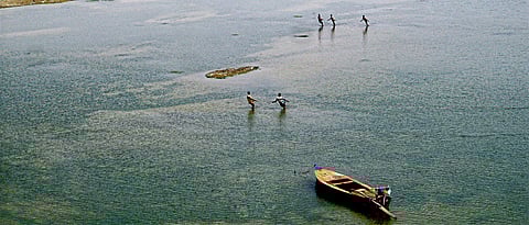

Bhikhnathori, a small hamlet in Bihar on the Indo-Nepal border, now feels orphaned after several pleas made by the villagers to make the nearest freshwater source of water, Pandai river, accessible to them went unheard.
The river flows from Nepal and enters India near this village. Still, these villagers aren’t allowed by the government to use the water from Pandai river and they struggle to make ends meet, at times resorting to stealing water. They are now called ‘water smugglers’ on the other side of the border.
Similar villages can be found on both sides of the borders we share with Pakistan, China, Bangladesh and Bhutan with whom we also share some precious rivers. These rivers, the lifelines that should flow freely, flow within the limitations of diplomacy laid by the government of both sides.
Water is a fundamental human need that we have been blessed with through seas and rivers. Of the total water available on earth, only 3 per cent is usable that we get access through freshwater rivers. India has a number of these rivers like the Ganga, Yamuna, Brahmaputra, and Jhelum, which have now become a critical national asset.
These rivers quench the thirst of millions of people but also lead to socio-economic development of the region by providing ample opportunities to use water for irrigation, hydroelectric projects, industrial purposes and sanitation that improves the quality of life. However, the water sector now increasingly faces the challenge of bridging the demand-supply gap due to population increase and climate change.
The Union Ministry of Water Resources estimated that India’s water requirements to be around 1,093 BCM for the year 2025 and 1,447 billion cubic metre (BCM) for the year 2050. With projected population of 1.6 billion by 2050, the total available water resources would barely match the total water requirement of the country. In 1951, the annual per capita availability of water was 5,177 m3, which reduced to 1,342 m by 2000. The facts indicate that India is expected to become ‘water stressed’ by 2025 and ‘water scarce’ by 2050.
Now, if this is India’s state, one can only begin to wonder how grave the problem becomes when we come to consider our neighbours, who also have to consider the water needs of people in their heavily populated country just like ours. While the rivers link countries together, they also bitterly divide them.
Despite the large river systems in the Indian subcontinent, (prominently the Indus basin in the west and the Ganga-Brahmaputra-Meghna basin in the east), countries have grown protective and possessive over the rivers that flow through their territories. Considering the hydrological contours, countries are either upper or lower riparian, or both, depending on the flow of water.
Both river systems originate in the serene Himalayan glaciers of Tibet called the ‘water tower’ of South Asia. China annexed Tibet in 1950 and gained control over the Himalayan glaciers of the region where some of the world’s largest rivers originate and flow to South and Southeast Asia.
India is an upper riparian with respect to Pakistan and Bangladesh and a lower riparian with respect to Nepal, Bhutan, and China. This makes India’s hydro-diplomacy unique and complex.
The flow of water has caused a huge dispute in out Indian subcontinent especially with out neighbour Pakistan.
Indus Water Treaty
Before partition, all the rivers of the Indus basin used to flow undivided and did not pose any problem of international law. However, the brutality that was brought forth during partition wasn’t limited to the people from both the sides of the border.
Given that the partition was done purely based on religious ties with no consideration for geographical, physical or economic basis, it also meant the division of rivers that flowed through the two countries and the intricate British-designed canal system, regarded as the foundation of the region’s economy. Pakistan got most of the canals and the irrigated land but the partition left all of the headwaters’ tributaries in India.
The issue caught the eye of Eugene Black, then president of the World Bank, who suggested to form a working group of engineers from both the countries, with engineers from the World Bank offering advice. By 1954, the World Bank was ready with a proposal but politics took the better of these friendly discussions and it took six years of talk after which the two nations agreed and Indian Prime Minister Jawaharlal Nehru and Pakistani President Mohammad Ayub Khan finally signed the Indus Waters Treaty in September 1960.
While Pakistan got waters of the western rivers - the Indus, Jhelum, and Chenab, India got those of the eastern rivers - the Ravi, Beas and Sutlej.
India being upper riparian, most of Pakistan’s rivers flow through India first, which allows India to use them for irrigation, transport and power generation as per the treaty. The treaty is seen as one of the most successful international treaties, having survived frequent conflicts and even wars.
Still, Pakistan fears that India stops and diverts water before it enters Pakistan. It raised an issue with the World Bank regarding the 330 MW Kishanganga project in Kashmir’s Gurez valley recently, that the project will disrupt its supply of water, only to see the judgment fall in India’s favour.
The coming future holds what they call a ‘water war’. India, in its difficult neighbourhood, will have to live with transboundary rivers arrangement but also critically consider how to reshape the existing treaties.
